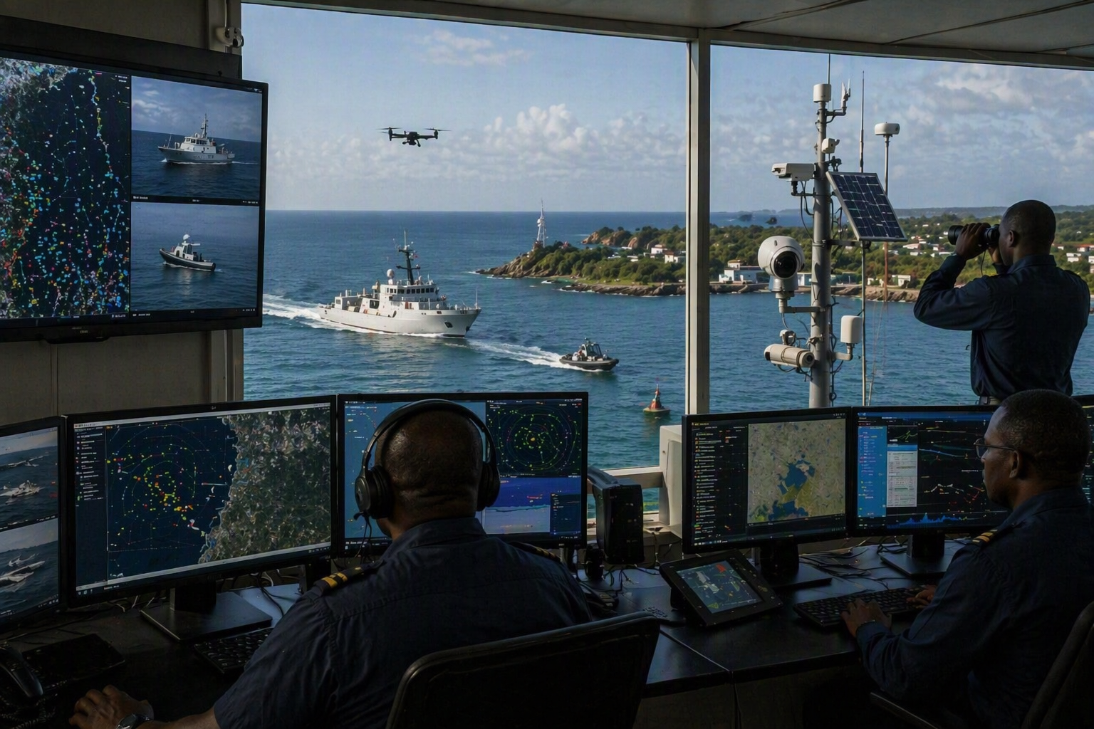
Africa's coastline is an economic asset, a food source, a trade corridor and a security frontier. Yet for many coastal states, large parts of the exclusive economic zone remain difficult to monitor consistently. Vessels move with AIS switched off. Illegal fishing fleets exploit weak surveillance gaps. Smugglers use busy shipping routes as cover. Pollution incidents may be detected too late. Ports, offshore energy assets and subsea infrastructure need better protection than periodic patrols can provide.
That is the practical value of maritime domain awareness. It gives authorities a working picture of what is happening at sea: vessels, people, cargo, infrastructure, patterns of movement and events that may affect security, safety, the economy or the environment. Pegasus defines maritime domain awareness this way in its MDAS offering, with an emphasis on real-time situational awareness for threat detection and response.
For Africa, this is not an abstract technology conversation. The African Union has estimated that illegal, unreported and unregulated fishing costs Africa about $11.2 billion in annual revenue, with consequences for food systems, marine ecosystems and governance. The FAO also describes IUU fishing as one of the greatest threats to marine ecosystems, particularly in developing countries where monitoring, control and surveillance capacity is limited. [au.int] [fao.org]
What maritime domain awareness actually does
A good maritime domain awareness system does more than show dots on a map. It brings together data from multiple sources, then turns that data into alerts, evidence and operational decisions.
Pegasus MDAS is built around multi-source fusion, including AIS, satellite AIS, LRIT, VMS, SAR and optical imagery, ship information, RF detection and other data sources. The Maritime Awareness System stores, processes and queries these feeds so maritime authorities, coastguards, law enforcement agencies and navies can monitor activities at sea. Pegasus also describes its MDAS web solution as continuous maritime intelligence through AIS, RF and EO/SAR fusion to detect illicit activity, dark vessels and underwater intrusions across coastal and EEZ waters.
This matters because many maritime threats are behavioral. A vessel that loiters near a protected fishing ground, disappears from AIS, meets another vessel offshore, then reappears on a new course may be more interesting than a vessel that simply crosses a line on a chart. Pegasus' MDAS capability includes analysis of loitering, AIS gaps and suspicious transfers, with automated alerts for interdiction and operational response.
Why Africa needs persistent maritime surveillance
Patrol vessels and aircraft remain important, but they cannot be everywhere. That is the hard part. African maritime zones are large, budgets are limited, and illegal operators understand where visibility is weak.
In the Gulf of Guinea, piracy incidents have declined from earlier peaks, but the region remains a concern. The Atlantic Council notes that the threat has adapted and still affects countries from Nigeria and Benin to Ghana, Côte d'Ivoire, Cameroon, Equatorial Guinea and Gabon. MARAD's 2025 advisory also warns that piracy, armed robbery and kidnapping for ransom continue to threaten vessels and crews operating in the Gulf of Guinea. [atlanticcouncil.org] [maritime.dot.gov]
On the fisheries side, the problem is equally serious. AU-IBAR has described IUU fishing as a threat to Africa's blue economy, food security, aquatic biodiversity and the livelihoods of millions. It also notes that weak and fragmented monitoring systems allow illegal operators to exploit gaps between jurisdictions. [AU-IBAR an...ng Threats]
Maritime domain awareness helps close those gaps. It does not replace patrols. It makes patrols smarter. Instead of sending limited assets into wide areas with little context, authorities can cue patrols toward suspicious behavior, dark vessel detections, illegal transfers, restricted-zone incursions or environmental incidents.
From surface tracking to underwater protection
Many discussions about maritime domain awareness focus on vessels. That is only part of the picture. Ports, offshore platforms, subsea cables, energy infrastructure and restricted harbors also need protection below the surface.
Pegasus' MDAS offering includes stationary self-powered surveillance buoys and roaming uncrewed surface vessels. The buoy platform is designed for 24/7/365 persistence using wind, solar and wave power, with remote real-time communications, long-term global deployment experience, TRL 9 maturity, Sea State 5 operation and a 15-year lifetime. The roaming WAM-V uncrewed surface platform is described as a stable payload platform with wave-riding articulation, Sea State 5 operation, proven swarming and force multiplication, over 100 systems delivered and global deployment experience.
These platforms extend surveillance into places where fixed coastal infrastructure may not reach. They can support harbor monitoring, critical underwater infrastructure protection, environmental monitoring, mine countermeasures, hydrographic work and defense applications. For intruder detection, Pegasus lists sonar options for fixed and mobile deployments, including GuardPoint 70 on a buoy and GuardPoint 400 on a WAM-V platform, with detection profiles for unmanned vehicles and divers under stated ideal conditions.
That is important for African ports and offshore assets. A suspicious vessel is visible on the surface. A diver, unmanned underwater system or underwater intrusion near a terminal may not be.
The role of satellites in maritime domain awareness
Satellites are changing maritime surveillance because they give coastal states a wider view than shore sensors alone. Pegasus' MDAS offering includes satellite intelligence for coastal, resource and border monitoring, with SAR and EO imagery, vessel detection, change detection, object detection, time-series analysis and InSAR-based stability monitoring.
SAR is especially useful because it can support vessel detection in difficult lighting and weather conditions. Pegasus' MDAS materials describe AIS, SAR and EO data fusion for maritime surveillance, including correlation between satellite detections and AIS tracks. Non-correlated vessels can then be flagged for review. Pegasus also notes that Kenya sits within the NEqO constellation footprint, enabling around 3 to 4 revisits per 24 hours for coastal and resource zones.
This is where maritime domain awareness becomes more than monitoring. It becomes evidence. If an agency can show that a vessel went dark, appeared in SAR imagery in a restricted area, matched a pattern of suspicious behavior and later entered port, enforcement becomes easier to prioritize and justify.
A practical operating model for African maritime agencies
The strongest maritime domain awareness programs combine technology, people and procedure.
First, national agencies need a shared data layer. AIS, VMS, satellite imagery, RF detections, ship registries, port records, weather, oceanographic data and patrol reports should not sit in isolated systems. Pegasus' MAS is designed to store, process and query large volumes of maritime data, with an on-demand Earth observation module and a 24/7 analysis team.
Second, agencies need alert rules that match their missions. A fisheries authority may prioritize license violations and illegal transshipment. A navy may focus on smuggling, piracy and suspicious approaches to strategic infrastructure. A port authority may care most about restricted zone intrusion, underwater threats and pollution response.
Third, countries need regional coordination. The Africa Defense Forum notes that systems such as the Yaoundé Architecture Regional Information System have helped improve maritime domain awareness by encouraging information sharing among states. The African Union has also emphasized the importance of combined maritime efforts in addressing piracy in the Gulf of Guinea. [adf-magazine.com] [peaceau.org]
The cost of weak maritime visibility
If a country cannot see its waters, it cannot fully govern them. It loses fish, tax revenue, environmental control and confidence in its maritime borders. It reacts after incidents instead of detecting early warning signs.
Weak visibility also affects investment. Offshore energy, port expansion, coastal tourism, subsea cable routes and blue economy projects all depend on security and predictability. Maritime domain awareness gives governments a better way to protect those investments while supporting enforcement, conservation and national security.
Conclusion
Maritime domain awareness is becoming a core capability for African coastal states. The keyword may be technical, but the need is straightforward: know what is happening at sea, understand what looks abnormal, and act before a threat becomes a crisis.
Pegasus MDAS brings together satellite intelligence, AIS and RF fusion, EO/SAR analytics, self-powered buoy platforms, uncrewed surface vessels, underwater intrusion detection and 24/7 analysis support into an integrated surveillance approach. For maritime authorities, coastguards, navies, fisheries agencies and critical infrastructure operators, that kind of visibility can turn a vast maritime zone into a manageable operational picture.
The sea will not become less busy. The better question is whether African states will have the tools to see it clearly.